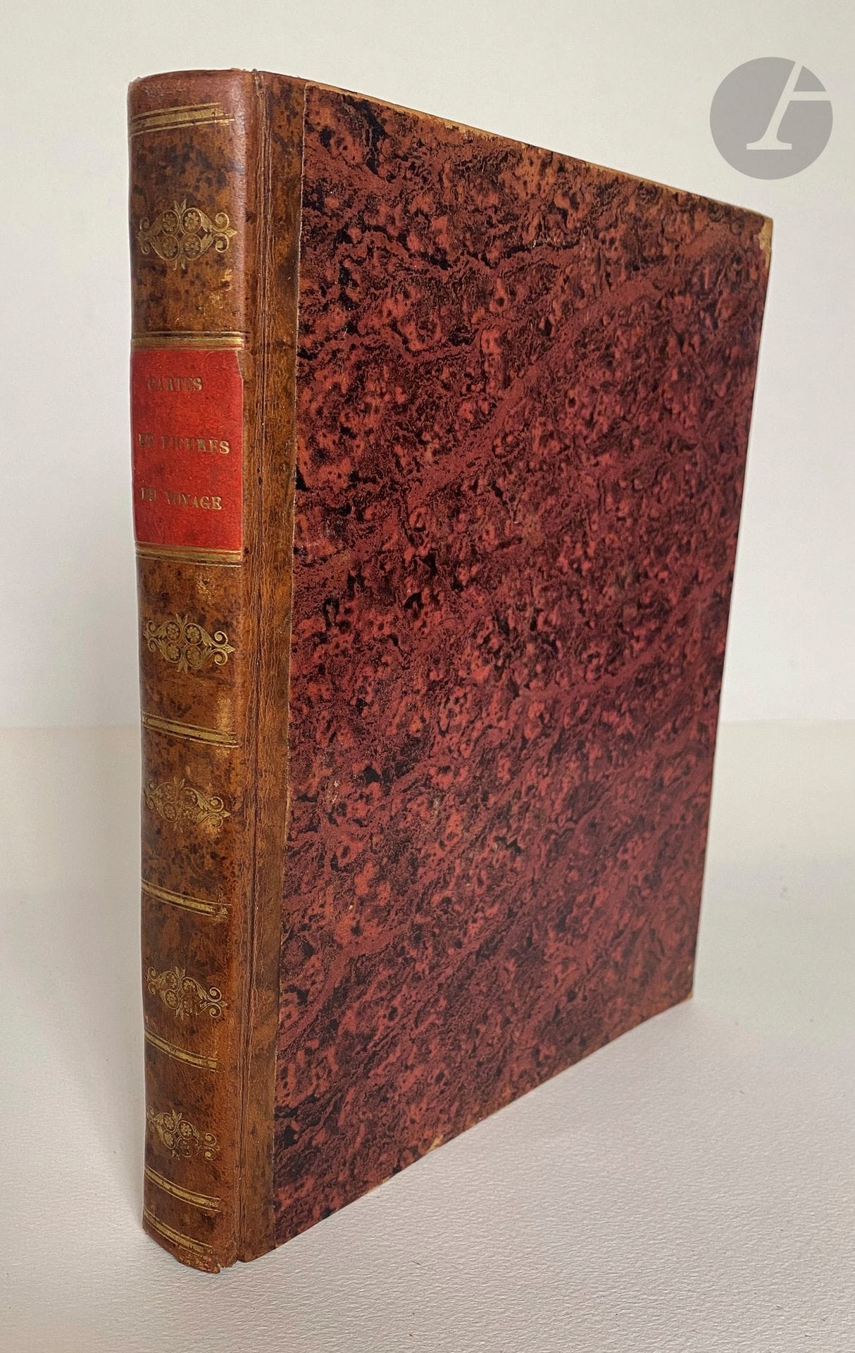
BRUCE (James). Cartes et figures du voyage en Nubie et en Abyssinie. Paris : Plassan, 1792. - In-4, half marbled calf, ornate smooth spine, marbled edges (early 19th century binding). The only atlas to accompany the French edition published between 1790 and 1792 of Voyage aux sources du Nil, en Nubie et en Abyssinie, pendant les années 1768, 1769, 1770, 1771 & 1772 by the Scottish traveler James Bruce and of Voyage de Paterson chez les Hottentots et les Cafres. James Bruce travelled through a large part of Ethiopia for 4 years, in search of the true sources of the Nile. He believed he had discovered them, when in fact they were only the Nile of Abyssinia, also known as the Blue Nile, Bah-rel-Azrek or Abaï, already described by his predecessors. When it was published, his account was shunned by the public, so much so that the facts described therein provoked doubt and bewilderment among unbelieving scholars and explorers. The veracity of his account was only belatedly recognized, thanks to the travelers Combes, Tamisier and Léon Delaborde, with the exception of his discovery of the sources of the Nile. The atlas comprises 88 plates, including 84 engravings depicting fauna, flora, costumes, antiquities and views of the countries visited, and 4 large fold-out maps. The first 65 plates and the first 3 maps concern James Bruce's voyage, while the other engravings illustrate Paterson's. Two tears, one restored, on the first two leaves, with damage to a figure in the list of plates. Some foxing and spotting. The lower edges of the first 8 plates and plates 24 and 25 show tears. Small tears, not missing, at the folds of the maps.
Estimate
€300 - €400
Result
€821
Buyer's premium
26%
BRUCE (James).
Cartes et figures du voyage en Nubie et en Abyssinie.
Paris : Plassan, 1792. - In-4, half marbled calf, ornate smooth spine, marbled edges (early 19th century binding).
The only atlas to accompany the French edition published between 1790 and 1792 of Voyage aux sources du Nil, en Nubie et en Abyssinie, pendant les années 1768, 1769, 1770, 1771 & 1772 by the Scottish traveler James Bruce and of Voyage de Paterson chez les Hottentots et les Cafres.
James Bruce travelled through a large part of Ethiopia for 4 years, in search of the true sources of the Nile. He believed he had discovered them, when in fact they were only the Nile of Abyssinia, also known as the Blue Nile, Bah-rel-Azrek or Abaï, already described by his predecessors. When it was published, his account was shunned by the public, so much so that the facts described therein provoked doubt and bewilderment among unbelieving scholars and explorers. The veracity of his account was only belatedly recognized, thanks to the travelers Combes, Tamisier and Léon Delaborde, with the exception of his discovery of the sources of the Nile.
The atlas comprises 88 plates, including 84 engravings depicting fauna, flora, costumes, antiquities and views of the countries visited, and 4 large fold-out maps. The first 65 plates and the first 3 maps concern James Bruce's voyage, while the other engravings illustrate Paterson's.
Two tears, one restored, on the first two leaves, with damage to a figure in the list of plates. Some foxing and spotting. The lower edges of the first 8 plates and plates 24 and 25 show tears. Small tears, not missing, at the folds of the maps.
Sale
Tuesday 24 September 2024・14:00 (Europe/Paris)
Sale location coming soon
3, rue Favart
75002 Paris